Operational planning built for the field,
not five separate maps.Static presentations and Google Maps can't manage crowd movement or plan temporary infrastructure and resources. CAD requires a specialist and is difficult to keep up with updates. OnePlan lets police, fire, emergency services and every partner plan, manage and brief any operation on one accurate, live map and update it the moment the plan changes.
Trusted by event and operations teams in 150 countries and tested at the world's largest events.
See OnePlan in Action
Talk to us about your planning concerns and see how we can help.
Book a demo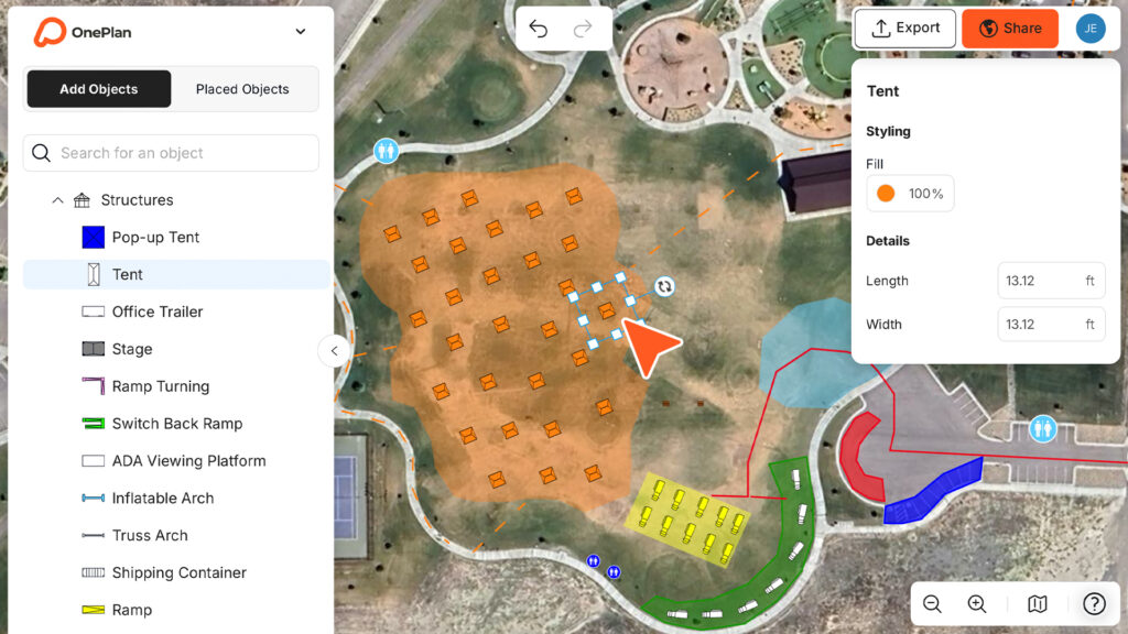
Tested where coordination matters most
Paris 2024
Silverstone
CFL
USA Triathlon
Special Olympics
200,000+
Events planned
150
Countries
Up to 85%
Planning time saved
Olympic tested
From a town parade upward
Plan the events, sites and operations you're responsible for
From a single street festival to a multi agency major event, it's the same easy platform, always to scale. OnePlan scales with you, your organisation and partners.
Planned events & crowds
Parades, marathons, festivals, game days and demonstrations. Lay out posts, crowd areas, road closures and routes to scale, and model capacity and flow before the day.
Multi agency operations
Police, fire and external partners on one live plan, with access set by role. Everyone briefs from the same current map, not five different versions emailed around.
Pre incident & venue plans
Import school, stadium, transit and venue plans and build reusable plans to scale, covering entry points, staging, rally points and triage, all current year after year. No technical CAD skills required.
OnePlan is used for dignitary protection & motorcade routing, tabletop exercises & training, and producing ops order maps for command briefings.
See the whole operation, the moment it changes
Drag and drop barriers and infrastructure, draw routes, mark road closures and outline crowd areas, all to scale on a real map. When someone moves a barrier or adds a unit, everyone sees it live. No resending files, no guessing which version is current.
Toggle layers per agency · lock what shouldn't change · share a secure view only link with command in one click.
Stop briefing from five different maps
From disconnected PDFs and CAD drawings to last minute changes, OnePlan eliminates version control issues and keeps every agency aligned on one plan they can actually build on.
One plan, every agency
Live collaboration and access set by role keep police, fire and partners on the latest version, always.
Model crowds before the day
Crowd capacity, arrival and exit calculators show what's safe and what flows, before anyone deploys.
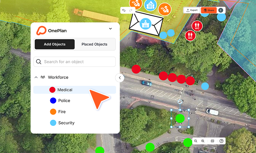
Plan officers, posts & routes (including What3Words)
Drop staff as dots with assignments, shifts and notes, and draw the routes each unit needs to cover.
Works with your CAD & GIS
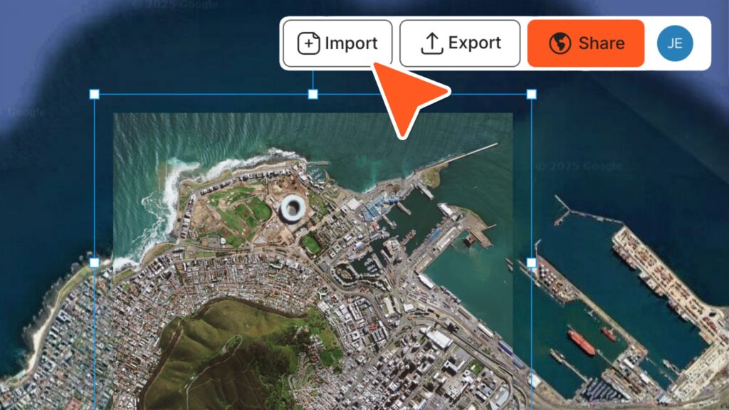
Import CAD and layouts as a base and build on top. OnePlan is your planning layer, alongside the systems you already run.
Brief command in minutes
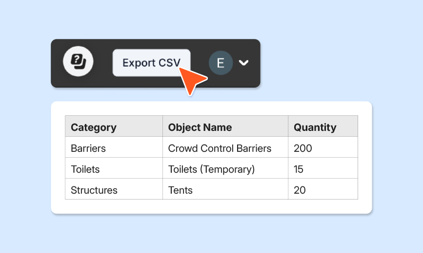
Export ops maps ready to print and drawn to scale, plus a full inventory for the ops order and the morning brief.
Reuse last year's operation
Turn last year's plan into this year's starting point, a living plan that's current right up to the day.
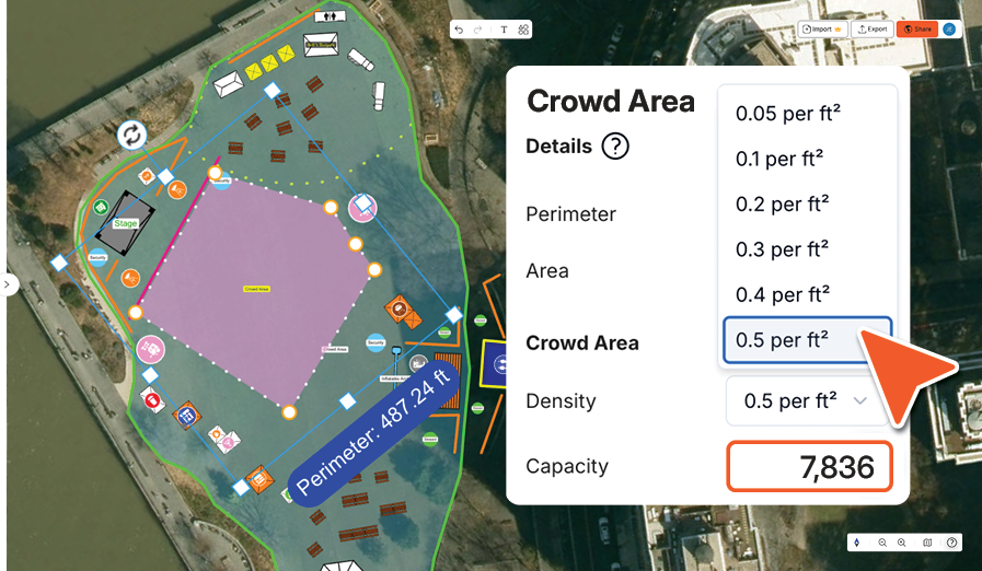
Defensible crowd figures
Outline an area and OnePlan returns its size and a safe capacity you can stand behind in a Safety Advisory Group or permit review.
Everything to scale
Draw barriers, fencing and routes to real world measurements, so what you plan is what fits on the ground.
Bring your plans in. Brief your team out.
No rip and replace. Import what you have, plan on accurate maps, then export and share with anyone. No account needed for view only links.
CAD & GIS layouts
Import & overlayFloor & site plans
Plan on topSatellite & aerial
Accurate basemapsOps maps to scale
Export to briefSecure view only links
Password protected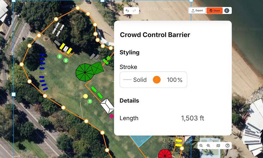
Your planning layer, not your dispatch system
OnePlan is where you design, model and brief the operation. It works alongside your CAD, RMS and GIS; it doesn't replace dispatch or live tracking. That focus is exactly why teams get a clear, defensible plan in front of every agency, fast.

If we compare it to CAD, OnePlan works much better for our needs. It would take me a day to do eight maps in CAD. In OnePlan, it's just two hours.
Sam Wilson
National Operations Manager, Stadium
On Coventry Moves, a 12 hour event with ~400 road closures across 7 procession routes, planned for 110 stakeholders in OnePlan.
From a town parade up to the world's biggest events
The same easy platform that coordinated Paris 2024 across dozens of venues scales down to a single street festival. Scale up your plan only when you need to.
46
venues coordinated at Paris 2024
2,400+
collaborating users on one platform
~400
road closures planned at Coventry Moves
110
stakeholders briefed from one plan
What public safety teams ask us
Is OnePlan a CAD, RMS or dispatch system?
No. OnePlan is your planning and briefing layer. It's where you design the operation, model it to scale and get every agency on the same plan. It works alongside the CAD, RMS and GIS you already run; it doesn't replace dispatch or live unit tracking.
Can multiple agencies work in the same plan?
Yes. Police, fire, EMS and external partners can all work in one live plan, with access set by role (editable or view only) and password protected share links, so everyone sees the right level of detail and briefs from the same current map.
Do we need GIS or CAD skills to use it?
No. OnePlan is drag and drop, and you can be placing posts and barriers within minutes. It was built for operators, not engineers; no learning curve and no degree required. There's a free OnePlan Academy course if you'd like a hand getting started.
How accurate is it, really?
Everything is to scale on a live satellite or street map built on Esri's ArcGIS, the standard public safety teams already trust. Place a barrier, and it stays correct as you zoom; outline an area, and OnePlan instantly returns its size and a safe crowd capacity you can defend in a Safety Advisory Group or permit review.
How do agencies buy OnePlan?
Agencies use annual team plans with invoicing that suits your PO process, and we can support cooperative purchasing routes to simplify procurement. Talk to us about the right option and any security documentation your IT or procurement team needs to review.
Can grant funding cover it?
Many agencies fund planning tools through homeland security and similar grant programs. Eligibility varies, so check with your grants office. We're happy to help you scope where OnePlan fits.
Can we reuse a plan year after year?
Yes. Save any operation as a reusable template drawn to scale, and update it instead of rebuilding, a living plan that's current right up to the day of the event.
Plan your next operation the easy way
Whether it's a parade, a marathon, a major event or your venue plans, OnePlan helps you plan accurately and keep every agency aligned.
Your first plan is on us · No installation required · No credit card